
Subsurface Utility Information
Subsurface Utility Information
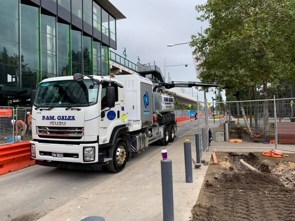
We at P&M Galea, offer extensive Subsurface Utility Information services with the adoption of the latest tools, equipment and methods; vital to the successful and safe construction in infrastructure projects. We carefully identify, map out and document underground utilities, providing our clients with critical insights into the subterranean of their project location to assist with project planning and execution.
In essence, P&M Galea, aims to provide the most up-to-date and relevant information regarding subsurface environments at each client’s project site to minimise potential impacts of accidental damage to; water mains, gas lines, underground cables and much more.


Benefits of Subsurface Utility Information by P&M Galea
-
By utilising advanced technologies like ground-penetrating radar (GPR) and electromagnetic locators, P&M Galea achieve precise and accurate mapping of subsurface utilities (cables, pipes and voids), reducing the risk of causing preventable errors occurring during construction.
-
Subsurface Utility Information empowers clients to optimise project planning and design. It is by providing a clear understanding of the underground landscape from the beginning that will prevent delays, and costly redesigns in the means of altering an existing plan due to unexpected obstacles.
-
With a thorough understanding of subsurface utilities in a project location, this enables careful planning, reducing unnecessary excavation of materials and henceforth reducing the environmental impact of construction activities.
-
By preventing unexpected utility strikes and associated costs of liability and repair, P&M Galea’s Subsurface Utility Information services proactively provide overall cost savings for clients preventing them from incurring significant unexpected costs due to negilience.
How does Subsurface Utility Information work?
Subsurface Utility Information (SUI) embraces the use of a multitude of technologies and methods (vacuum excavation samples, ground-penetrating radar assessments, and/or electromagnetic locators) to accurately gather information and note down for reference regarding underground utilities, structures, and pipelines. The objective is to provide detailed information about the subsurface environment, helping to avoid unintended damage to infrastructure during excavation that could have been avoided.
For a clear and accurate picture of the subsurface environment, for your next project contact the team at P&M Galea today and book your Subsurface Utility Information services. We cover Sydney, Newcastle and Wollongong localities.

Frequently Asked Questions
-
Subsurface utility information (SUI) is the process of identifying, mapping, and documenting underground utilities before construction begins. This critical service helps locate water mains, gas lines, electrical cables, telecommunications infrastructure, and other buried assets at project sites. SUI is essential because it prevents costly utility strikes during excavation, ensures worker safety, avoids service disruptions to surrounding areas, and enables accurate project planning. For Sydney's densely developed urban environment with complex underground infrastructure, SUI is vital for any construction or development project.
-
P&M Galea utilises advanced technologies including ground penetrating radar (GPR), electromagnetic locators, and vacuum excavation sampling to accurately detect and map underground utilities. GPR sends radio waves into the ground to identify buried objects and voids, whilst electromagnetic locators trace metallic utilities like pipes and cables. Vacuum excavation provides physical verification by carefully exposing utilities for precise location confirmation. This combination of non invasive and minimally invasive technologies ensures comprehensive and accurate subsurface mapping across Sydney construction sites.
-
SUI services provide significant cost savings by preventing expensive utility strikes that can cost thousands to tens of thousands of dollars in repairs, project delays, and potential liability claims. Accurate subsurface mapping eliminates costly redesigns when unexpected utilities are discovered during construction, reduces insurance premiums through demonstrated risk management, and prevents emergency repairs and service restoration expenses. For Sydney projects where underground infrastructure is particularly dense, investing in SUI at the planning stage avoids budget overruns and keeps projects on schedule, ultimately protecting your bottom line.
-
SUI services are essential for virtually all construction and infrastructure projects including commercial developments, residential building sites, road and rail construction, tunnelling and drilling operations, telecommunications installations, landscaping projects requiring deep excavation, and utility installation or upgrades. Government and council projects throughout Sydney mandate SUI to comply with safety regulations and protect public infrastructure. Even smaller projects like pool installations or fence post digging benefit from utility location services to avoid striking underground services.
-
P&M Galea provides comprehensive subsurface utility information services across Sydney, Newcastle, and Wollongong regions throughout New South Wales. With nearly three decades of experience since 1996, the company has extensive knowledge of underground infrastructure across the greater Sydney metropolitan area. Their team services both urban and suburban locations, bringing advanced detection equipment and expert technicians to accurately map subsurface utilities regardless of project location or site complexity within their service regions.
-
Modern SUI services using GPR, electromagnetic detection, and vacuum excavation sampling provide highly accurate utility location data, typically within centimetres of actual position. After completing the survey, P&M Galea provides detailed mapping and documentation showing the precise location, depth, and type of all identified underground utilities at your Sydney project site. This information integrates into your project plans, enabling contractors to excavate safely and efficiently. The comprehensive documentation also serves as a valuable reference throughout the construction process, ensuring all teams have access to critical subsurface information for safe work practices.